 European cooperation: eEarth, GEOMIND, Geo-Seas, Waterprotect
The CBDG team is one of the partners that originated the European projects called eEarth, GEOMIND, Geo-Seas and WATERPROTECT. Created in international collaboration, the Internet multilingual applications offer access to data on boreholes and geophysical surveys.
Waterprotect
 The CBDG team, in close cooperation with the PGI-NRI hydrogeologists and Polish partners: the West Pomeranian University of Technology and the Institute of Technology and Life Sciences, took part in the Waterprotect Project (2017-2020), which aimed to develop modern principles of water resources management and effective water protection in areas agricultural use. The project was implemented in 7 European countries in the catchments of various rivers by a total of 28 companies and institutions. As a result, the so-called Collaborative management tool supporting the management of the catchment area. Specifically, the CBDG team created a dedicated repository of harmonized data and two map applications: Portal WATERPROTECT and WATERPROTECT mobile application, presenting various types of data useful in the management of the catchment area.
GEOMIND
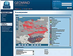
 Closely cooperating with other PGI departments, the CBDG team actively participated in the international project called GEOMIND, prepared by a consortium of 12 partner institutions from 9 European countries. As a result, a multilingual Internet portal was established to integrate geophysical data obtained from resources of the countries involved in the initiative.
Moreover, international standards of representing both metadata and detailed data were set, which promotes further integration and popularization of European and global geoinformation. The project closed, inactive.
Geo-Seas
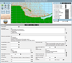
 Geo-Seas is a project whose aim is to bring together in one place information about the data in the field of geology and geophysics acquired during the study of marine areas in Europe. These data come from 26 research centers located in 17 countries. In Poland, the center is the Marine Geology Branch PGI-NRI.
The combination of information relating to the common areas of research led to the build platform for exchange of geological and geophysical data.
The effects of these works are one of the segments of the European system of management of marine and ocean data - "SeaDataNet". This system collects information about the marine environment and ocean from various fields of science, contributing to the interdisciplinary exchange of information between scientists, state geological surveys, and other organizations.
eEarth
 The eEarth system enables the users to browse borehole data collected by six European geological surveys: British, Dutch, German, Polish, Czech and Lithuanian. Additionally, the multilingual website with the GIS functionality provides borehole data in seven languages: English, Dutch, German, Polish, Czech, Lithuanian and Italian.
The project closed, inactive.
21st annual GIC conference
 In 2006, CBDG employees, acting on behalf of PGI-NRI, organized the 21st annual conference of the GIC - Geoscience Information Consortium. The conference was attended by 33 representatives of 22 national geological surveys. The conference website was created in 2006 as a flash application. For security reasons, these types of apps are currently blocked. Therefore, we only present screens and key information from the original application. Archived version of the GIC-21 Conference website