GeoLOG Application
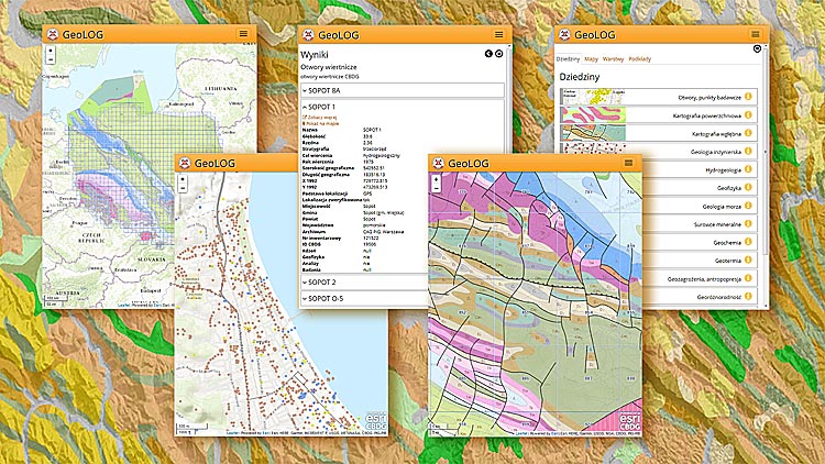 CBDG GeoLOG Application was created especially for use on mobile devices - smartphones and tablets. This application is based on map services provided from the largest geological database – CBDG. Thanks to it, you can access very detailed data directly from the map, in any place, in the field, where only there is access to the Internet.
To make it easier to navigate through such a large amount of information, the 70. maps that the application contains have been divided into 14 thematic areas. Additionally, the application has a map search engine. In total, in the CBDG GeoLOG Application, there are 524 thematic layers that can be freely combined to create various map compositions on the screen. For a better visualization of geological data, the user can choose one of 13 base maps. The map composition created during the work can be saved and also shared in e.g. social networks.
At https://geolog.pgi.gov.pl, there is a lot of knowledge in many fields of geology in one place - the effect of field work and detailed research of many generations of geologists.

 The CBDG GeoLOG Application is also available for free in the Google Play and App Store. The current version of the application in these stores does not work properly and requires fixes, which will be implemented soon.
GeoLOG Application Content
1. Boreholes, research points
- Boreholes http://otwory.pgi.gov.pl
- Hydrogeological objects
- Boreholes engineering-geological
- Research points
- Research points for SMG
2. Superficial deposit maps
- Geological Map of Poland 1:1 000 000
- Geological Map of Poland 1:500 000
- Geological Map of Poland 1:200 000
- Serial map sheet 1:50 000 - the aggregate index for: SMGP, MGśP i MHP
- Geological Map of Poland 1:50 000 (SMGP) - Detailed geological map of Poland is the primary resource of information for the other maps.
- Lithogenetic Map of Poland 1:50 000 (MLP)
- Geoenvironmental Map of Poland 1:50 000 (MGŚP) - sheets A and B
- Geological investigation along the infrastructure investment showing the degree of compliance with the SMGP
- Geological map of Tatra Mts.1:10 000 (SMGT)
3. Bedrock maps
- Geological map without Cenozoic deposits 1:1 000 000. Map under scientific leadership by Ryszard Dadlez, Sylwester Marek i Jędrzej Pokorski (2000)
- Geological map of horizontal cutting on a scale 1:750 000 based on Polish Geological Atlas under scientific leadership by Zbigniew Kotański (1997)
- Geological Map of Poland in 1:200 000 without Quaternary deposits
- Geological Map of Tatra Mountains 1:10000 (SMGT) without Cenozoic deposits
- Geological Map of Tatra Mountains 1:10 000 (SMGT) tectonics
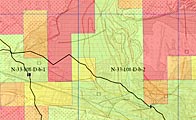
4. Engineering geology
- Boreholes engineering-geological
- Engineering-geological atlases
- Engineering-geological Map of Poland 1:300 000
- Engineering-geological Map of Poland 1:500 000
- Physical and mechanical properties of land and rocks
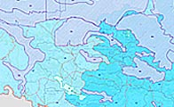
5. Hydrogeology
- Hydrogeological objects
- Groundwater monitoring
- Areas at risk of flooding in Poland
- Major Groundwater Reservoirs (GZWP)
- Groundwater bodies existing in the current cycle of water - up to 2015 and for the years 2016-2021
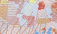
6. Geophisics
- Geoelectrical sounding VES
- Geoelectrical documentations
- Magnetotellurics - information on the sites of magnetotellurics measurements acquisited until the end 2011
- Magnetometry - information on the sites of the Earth's magnetic field intensity measurements (the vertical component Z)
- Gravimetry - information on the sites of gravimetric measurements
- Seismic 2D and 3D - Information on seismic 2D lines and 3D surveys acquisited digitally in Poland
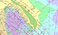
7. Marine geology
- Marine documentation points and lines
- Bathymety of the Baltic Sea
- Lithological map of the Baltic Sea
- Geological map of the Baltic Sea
- Geological map of the Baltic Sea bottom without quaternary deposits
- Index of map sheets of the Baltic Sea
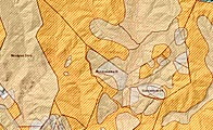
8. Mineral resources
- Mineral deposits, mining areas, mining countries - information based on the MIDAS service http://midas.pgi.gov.pl, which is the primary source of information about Polish mineral raw materials and closely related to mining issues
- Deposits crossed out of the domestic balance of mineral resources deposits, for which the data source has been specified
- Prognostic areas - areas of occurrence of surface mined minerals and selected underground, in which the raw material has known geological and mining parameters, quality properties of the mineral and specific estimated resources.
- Prospective areas - areas of rocks and natural fluids that have the characteristics of minerals, and the geological and mining conditions do not exclude the possibility of their exploitation. For these areas, there are incomplete data on geological, mining and quality parameters of the raw material.
- Areas of negative recognition - areas where the tests did not confirm the presence of the raw material or the mineral does not meet the currently applicable balance criteria.
- Verified areas of negative recognition - areas in which the research carried out as part of the Geoenvironmental Map of Poland did not confirm the existence of a raw material or the mineral does not meet the currently applicable balance criteria.
- Verified forecasting areas - selected areas located in non-collision areas in terms of environment and infrastructure, for which the works carried out under the Geoenvironmental Map of Poland (boreholes and qualitative tests) confirmed the presence of the mineral that meets the currently applicable balance criteria. The research concerned the areas of occurrence of natural sand-gravel aggregate and clay materials of building ceramics.
- Monitoring of Mineral Opencast Mining (MOEK).
- Places of mineral exploitation without concession.
- Concessions/projects of geological works for prospecting and exploration covered by mineral right:
- Hard coal and coal bed methane
- Chemical, rock and metallic deposits
- Curative, thermal waters and brines
- Hydrocarbons
- Hydrocarbons - tender blocks - 2016 (I round), 2017 (II round), 2018 (III round), 2019 (round IV), 2021 (round V).
- Extractive waste - information about mining waste sites on the Polish part of the Sudetes.
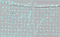
9. Geochemistry
- Geochemical atlases - basic data
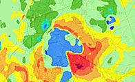
10. Geothermy
- Heat extraction value (2400h) [W/m] calculated for a drill hole with a depth of 40, 70, 100, 130 meters and 2400 annual operation hours of a geothermal heat pump
- Heat extraction value (1800h) [W/m] calculated for a drill hole with a depth of 40, 70, 100, 130 meters and 2400 annual operation hours of a geothermal heat pump
- Average value of thermal conductivity of rocks in watts per meter and kelvin [W/m*K]
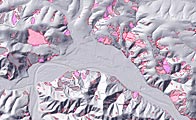
11. Geohazards, anthropopressure
- Anthropopressure - objects environmentally burdensome http://antropopresja.pgi.gov.pl/
- A pesicide landfills
- Landslides and areas at risk of (SOPO) - danger of surface mass movements http://osuwiska.pgi.gov.pl/.
- Areas at risk of flooding in Poland – flooding information.
- Areas of collision spatial development with environment (geology, protected areas).
- Extractive waste - information about mining waste sites on the Polish part of the Sudetes.
12. Geodiversity
- Geosites - information from the Central Register of Geosites in Poland http://geostanowiska.pgi.gov.pl/
- Caves - information about the caves Poland inventoried and collected in CBDG by the Polish Society of Friends of Earth Sciences http://jaskinie.pgi.gov.pl
- Geotourist maps
- Physico-geographical mesoregions of Poland - Based on the project "Verification of the boundaries of physical and geographical regions in SHP format (shapefile)", implemented by the Institute of Environmental Protection - NRI, based on the last physical and geographical division developed by prof. Jerzy Kondracki (1998, 2000) – source information
13. Historical Maps
- Index of historical maps
- Jean-Etienne Guettard (1715-1786) 1764 - Mineralogical Map of Poland (Carte Minéralogique de Pologne)
- Stanisław Staszic (1775-1825) 1806 - Geological map of Poland, Moldova, Transylvania and parts of Hungary and Wallachia (Carta geologica totius Poloniae, Moldaviae, Transylvaniae et partis Hungariae et Valachiae)
- Schulze 1812 - Mineralogical map of the Świdnica Mountains (Mineralogische Karte von Schweidnitzer Gebirge)
- Leopold von Buch (1774-1853) 1826 - Geological map of Germany. Wrocław (Geognostische Karte von Deutschland. Breslau)
- Karl Lill von Lilienbach (1798-1831) 1830 - Geological Map of the Gallicia Basin and Austrian Podolia (Carte Geologique du Bassin de la Gallicie et de la Podolie Autrichienne)
- Friedrich Gottlob Blöde (?–1866) 1830 - A petrographic map of the southern Kielce region (Petrographischer Charte von Demjeningen Theile von Pohlen welcher die Ubergangs-Gebirgs-Formation mit dem daran stossenden Flötzgebirge umfasst)
- Georg Gottlieb Pusch (1790-1846)
- 1836 - General geological map of the kingdom of Poland and Galicia with adjacent parts of Upper Silesia, Hungary, Transylvania, Moldau and Podolia (Geognostische General-Karte von dem Konigreichen Polen und Galizien mit angrenzenden Theilen von Oberschlesien, Ungarn, Siebenbrgen, Moldau und Podolien)
- 1837 - Geological map of the Świętokrzyskie Mountains between Sandomierz and Małogoszcz (Geognostische Karte des Polnischen und Sandomirer Mittelegebirges, zwischen Sandomierz und Malogoszcz)
- Rudolf von Carnall (1804-1874) 1854 - Geological map of Upper Silesia (Geognostische Karte von Oberschlesien)
- Ludwig Hohenegger (1807-1846)
- 1861 - Geological map of the North Carpathians in Silesia and the adjoining parts of Moravia and Galicia (Geognostische Karte der Nord Karpathen in Schlessien und den angrenzendem Theilen vou Maehren und Galizien)
- 1867 - Geological map of the former area of Krakow with the south adjoining part of Galicia (Geognostische Karte des ehemaligen Gebietes von Krakau met dem südlich angrenzenden Theile von Galizien)
- Jakub Stanowski (1818-1889), Albin Kohn (1820-1880), August Lubomęski (1820-1889) 1873 - Geological Map of the Grand Duchy of Poznań
- Karol Langie (1814-1889) 1874 - Geological map of the Kingdom of Galicia and Lodomerya
- Henryk Walter (1835-1921), Emil Habdank Dunikowski 1883 - Geological map of the petroleum area of the West Galician Carpathians (Geologische Karte des Petroleum Gebietes der Westgalicischen Karpathen)
- Emil Tietze (1845-1931)
- 1887 - Geological map of the Krakow area (Geologische Karte der Umgebung von Krakau)
- 1887 - Geological map of the area around Kraków-Chrzanów-Krzeszowice (Geologische Karte der Umgebung von Krakau-Chrzanów-Krzeszowice)
- Tadeusz Wiśniowski (1865-1933) 1900 - Geological map of the Krakow area
- Viktor Uhlig (1875-1911) 1903 - Carpathian tectonic sketch map (Tektonische Kartenskizze der Karpaten)
- Józef Grzybowski (1869-1922) 1912 - Overview geological map of the Polish lands and neighboring areas
14. Administrative divisions
- Administrative divisions - the Polish border, voivodeships, districts, communes
- Geological administration - geological administration employees
Additionally, you can use the WMS services from other servers, such as for example https://geoportal.gov.pl
Quick Reference Guide of GeoLOG Application
The Map
- Click, tap on the screen, hold and release, that is, select the objects - Select objects on the map with point or circle. The size of the circle depends on the length of the press. Information about objects will appear in the Results panel. There is a link Show on map and there may be an additional link See more redirecting to other domain applications with a wider range of information about the object.
- Dubble click - zoom and call the information panel as above.
- Multi Touch - pinch and strech - zoom in or zoom out the map scale.
- Drag - move the map
Menu
- Configuration - call the Map management panel:
- Layers - select the layers and their sequence, basic maps, add new WMS.
- Map sets - thematic blocks with easy-to-access handheld map information.
- Maps - selection of map services to display. The search box at the top helps you find the right layer. Here you can also change the order of layers. To do this, press and hold the layer for a moment and then move it to the desired position.
- Layers - enable or disable visibility of layers within map services and customize their transparency.
- Base maps - choose a base map of 13 different compositions.
- Legend - descriptions of objects displayed on the map
- Find a place - search location by: geographic names, zip codes, postal addresses, coordinates. Examples:
- Babia Góra,
- 02-521,
- Warsaw, ul. Rakowiecka 4,
- Coordinates N 52° 12' 32.112'', E 21° 00' 47.31'' in two ways:
- minutes, degrees, seconds - continuous recording (DMS, S), that is:
521232.112 , 210047.31; - degrees - decimal notation (DD), that is:
52.208920100461484 , 21.013141715301572.
- minutes, degrees, seconds - continuous recording (DMS, S), that is:
- My location - using the GPS signal or local Wi-Fi network, you can move and zoom the map to the location where you are.
- Add WMS - add new WMS.
- Import tracks - import GPS tracks in .kml or .gpx format.
- Share - three ways to share the currently viewed map:
- Ready code to embed a map on any web page,
- A link to a map that you can send, for example, by e-mail,
- Publish the map on social networks: Facebook, Twitter, Google+, LinkedIn.
- Information - information about the application and the data sources used in the app.
- Help- information about application functionalities.
- Terms of use - conditions of use of published data.
- Język / Language - switching the application language versions.
- Contact - contact information.
Attention!
- Visibility objects on the map - Due to the high detail or very large number of objects in some layers, viewing them is only possible closer to a small enough part of Poland i.e. at larger scales.
Accessibility declaration
Information about the availability of the GeoLOG application
 Boreholes, research points
 Surface geology
 Bedrock geology
 Engineering geology
 Groundwater
 Geophysics
 Marine geology
 Mineral resources
 Geochemistry
 Geothermy
 Geohazards, anthropopr.
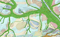 Geodiversity
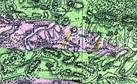 Historical Maps
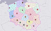 Administrative division
 Waterprotect Application